
The World Meteorological Organization (WMO) has released the latest update on hurricane-season early warning system development in the Caribbean. Between May and August 2026, the CREWS Caribbean 2.0 project drove major progress in the region around the goals of “more connected, more actionable, and people-centred” systems, advancing impact-based forecasting, warning dissemination, regional data exchange, and collaboration between meteorological and disaster management agencies.

In the Turks and Caicos Islands, a national-level campaign in May strengthened coordination among the national meteorological service, disaster management authorities, government communications offices, and the media. Participants mapped the warning dissemination process, identified operational bottlenecks, and agreed on improvements to optimize warning procedures, cross-agency collaboration, and outreach to vulnerable groups. This action model is expected to provide a reference for warning coordination in other Caribbean countries and territories.
At the regional level, a dedicated impact-based forecasting and Common Alerting Protocol (CAP) exercise in Trinidad and Tobago in late May was hailed as a regional milestone. Representatives from National Meteorological and Hydrological Services and disaster risk management agencies in 17 countries reviewed operational coordination mechanisms, harmonized standard operating procedures, and prioritized improvements, including clarifying institutional responsibilities, integrating CAP into warning workflows, setting impact thresholds, and strengthening coordination mechanisms. These measures help translate meteorological forecasts into clearer and better-coordinated warning actions.
Reliable and timely data sharing is the foundation for stronger forecasting and warning capabilities. In June, the project advanced WIS 2.0 (WMO Information System 2.0) and severe weather forecasting efforts to improve the efficiency and availability of meteorological data exchange in the Caribbean. Through standardized data interfaces and more open sharing mechanisms, national meteorological services can more quickly access regional observational data, supporting forecasts of hurricane track, intensity, and wind and rain impacts.
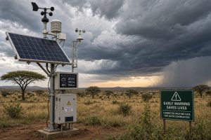
From a meteorological monitoring perspective, the Caribbean warning system upgrade reflects an important global trend in the warning industry: moving from “weather forecasting” to “impact forecasting.” Predicting weather phenomena alone is no longer sufficient to guide disaster prevention; it is necessary to further answer what impacts the weather will cause, which populations will be affected, and what actions should be taken. The introduction of the Common Alerting Protocol (CAP) and the harmonization of standard operating procedures allow different agencies and media to rapidly generate and disseminate consistent warning information, improving the “last mile” delivery of warnings. Meanwhile, modern data exchange mechanisms represented by WIS 2.0 are becoming the “nervous system” of regional meteorological monitoring networks, enabling data from observation sites scattered across islands—such as automatic weather stations and lightning detection equipment—to converge in real time and support more accurate monitoring and warning of severe convective weather.
Source: World Meteorological Organization (WMO) (link: https://wmo.int/media/project-update/strengthening-caribbean-early-warning-systems-ahead-of-hurricane-season)
 WMO Report Warns: Wildfires and Heatwaves Weigh on Global Ai
 Africa Early Warning Action Call Highlights Gaps in Meteorol
 Essential Autumn Maintenance Checklist for Automatic Weather