
The World Meteorological Organization (WMO) reported that severe flash flooding in Nepal on August 26 has caused heavy casualties. As of the evening of August 27, rescue workers had recovered 359 bodies, 73 people were injured, and many remain missing, including foreign tourists. According to Nepal’s National Disaster Risk Reduction and Management Authority, about 10,000 households are in urgent need of assistance; settlements, roads, bridges, and hydropower facilities have been washed away or damaged, with roads and power supplies cut off. A UN spokesperson said there would clearly be “large-scale humanitarian needs” after the disaster.
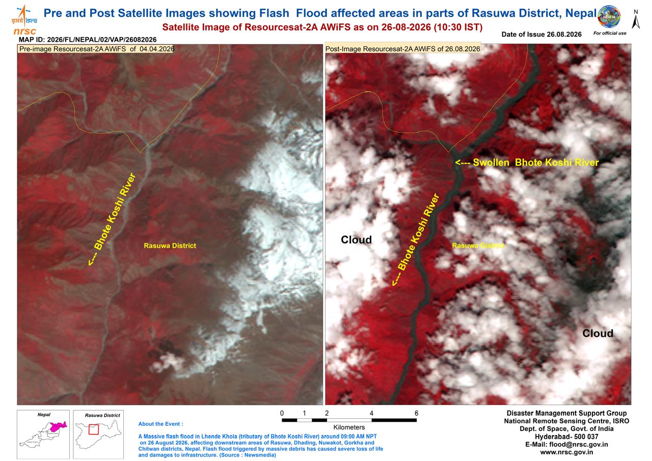
Preliminary reports suggest the flood may have been triggered by a glacial rock-ice avalanche on the Chinese side of the border with Nepal, in the Tibet Autonomous Region. The International Centre for Integrated Mountain Development and research institutions in Nepal and China are investigating the cascading process of “rock-ice avalanche – entry into river – landslide dam – outburst.” Based on field video and information from affected areas, large amounts of rock-ice debris likely entered the Lende River, a tributary of the Bhotekoshi River, temporarily forming a barrier in a narrow section, which then breached and released a torrent of water, sediment, and boulders downstream. Satellite images from India’s National Remote Sensing Centre before and after the disaster show surface changes in Rasuwa District.
WMO Secretary-General Celeste Saulo expressed condolences to the victims and solidarity with affected communities. She said the Rasuwa flood highlights the growing challenge of cascading hazards in high mountain areas. The source of the disaster may lie on one side of the border, while the impacts are concentrated on the other, underscoring prominent cross-border risks.
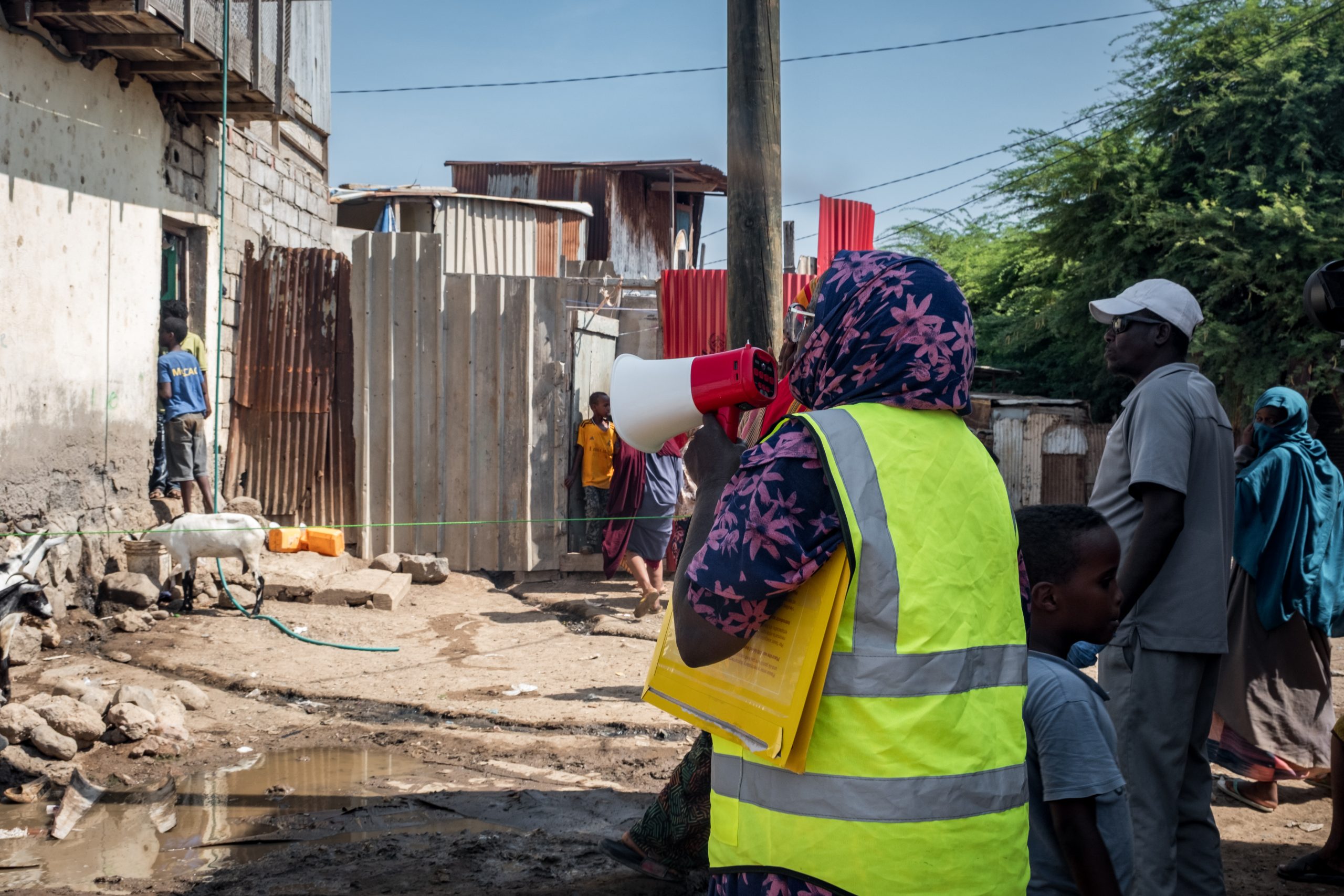
From the perspective of meteorological monitoring technology, such high-mountain cascading disasters place higher demands on the warning chain. A single weather station or remote sensing method cannot cover the entire process; a “space-air-ground” integrated observation system is needed: satellite remote sensing for wide-area identification of glaciers, snow cover, and surface deformation; lightning warning and atmospheric electric field monitoring to sense severe convective weather; micro weather stations and ultrasonic anemometers to capture local meteorological changes; water level and displacement sensors to help track landslide-dam stability and secondary disaster risks. Meanwhile, cross-border data sharing and warning information dissemination must be opened up to fill key gaps in the warning chain.
This disaster serves as another reminder that extreme weather and climate events in high mountain areas, intertwined with cryospheric processes, are creating compound risks that transcend individual hazards and administrative boundaries. Enhancing high-mountain disaster monitoring capabilities and strengthening coordinated responses between upstream and downstream countries are realistic pathways to mitigating similar tragedies.
Source: World Meteorological Organization (WMO) (Link: https://wmo.int/media/news/flood-tragedy-nepal-highlights-cross-border-and-cascading-risks)
 Nepal Flood Cascading Risks Highlight High-Mountain Weather
 WMO Supports Five Countries in Strengthening Multi-Hazard Ea
 Cabo Verde Validates Early Warning Roadmap After Tropical St